Detailes
Itinerary
Date and Processes
Location
11 Days Duration
0/10 Physical Level
Persons
16+ Min Age
2025-07-19/2025-07-29 Date From/To

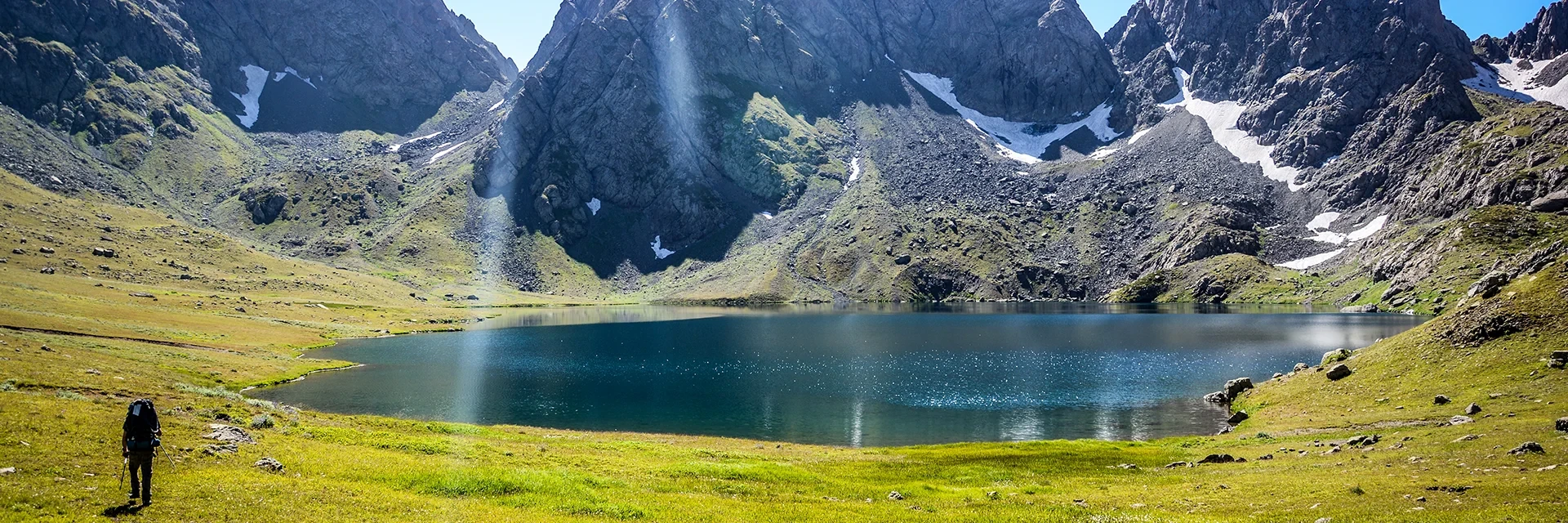
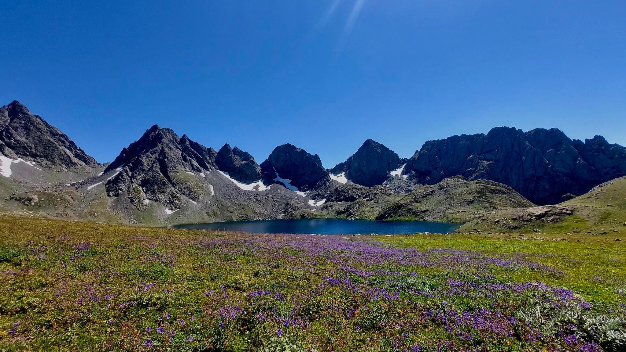
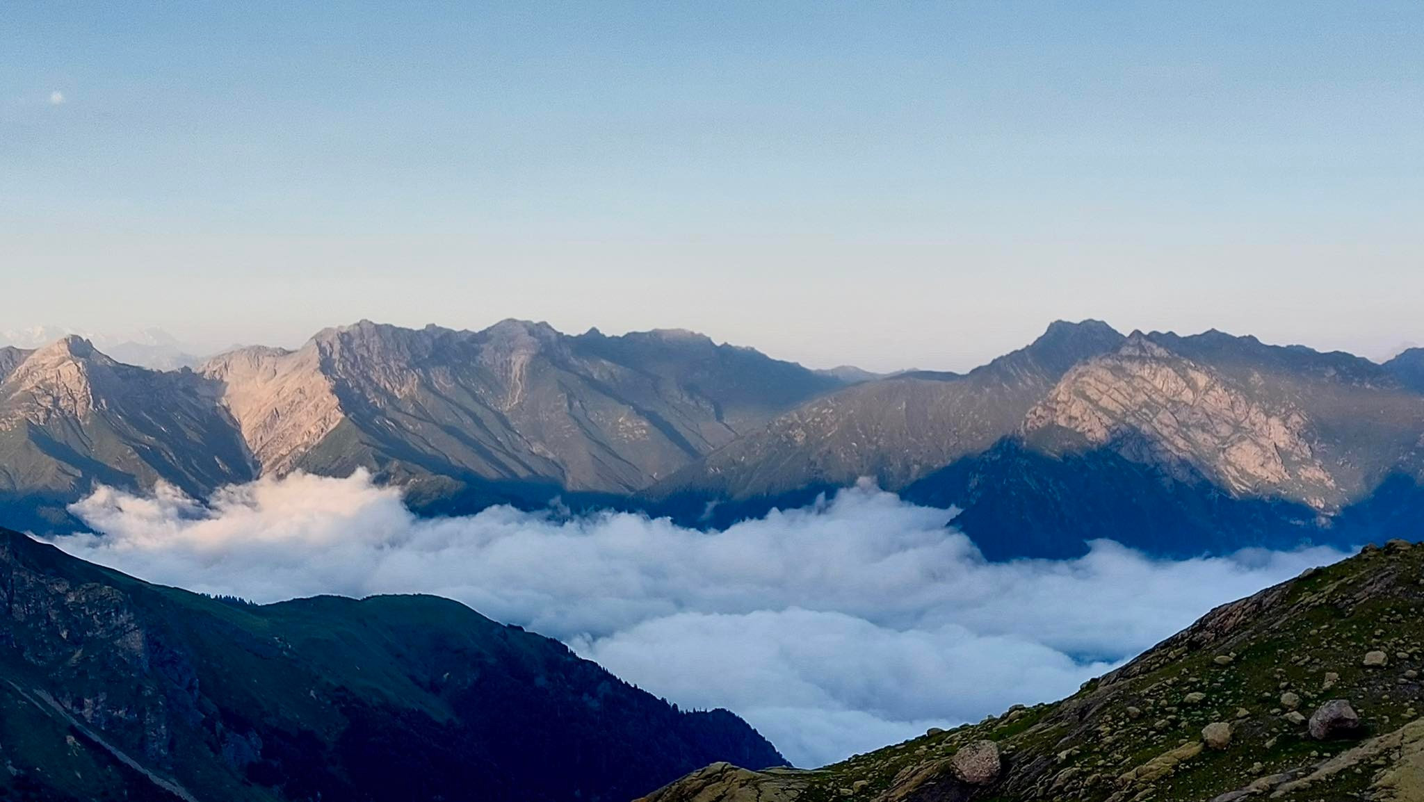
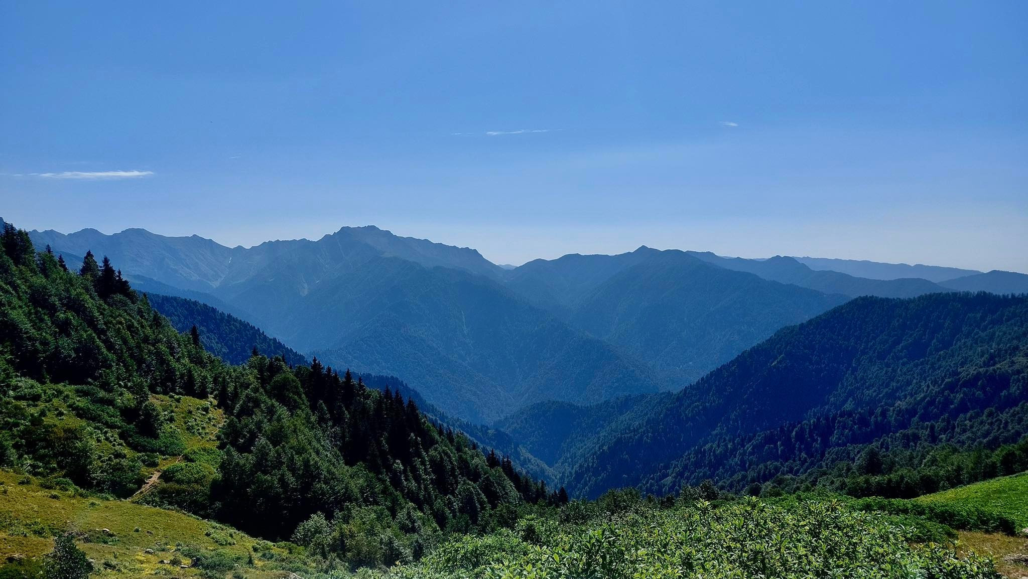
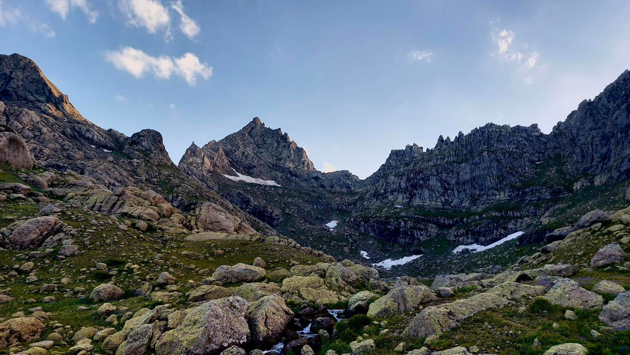
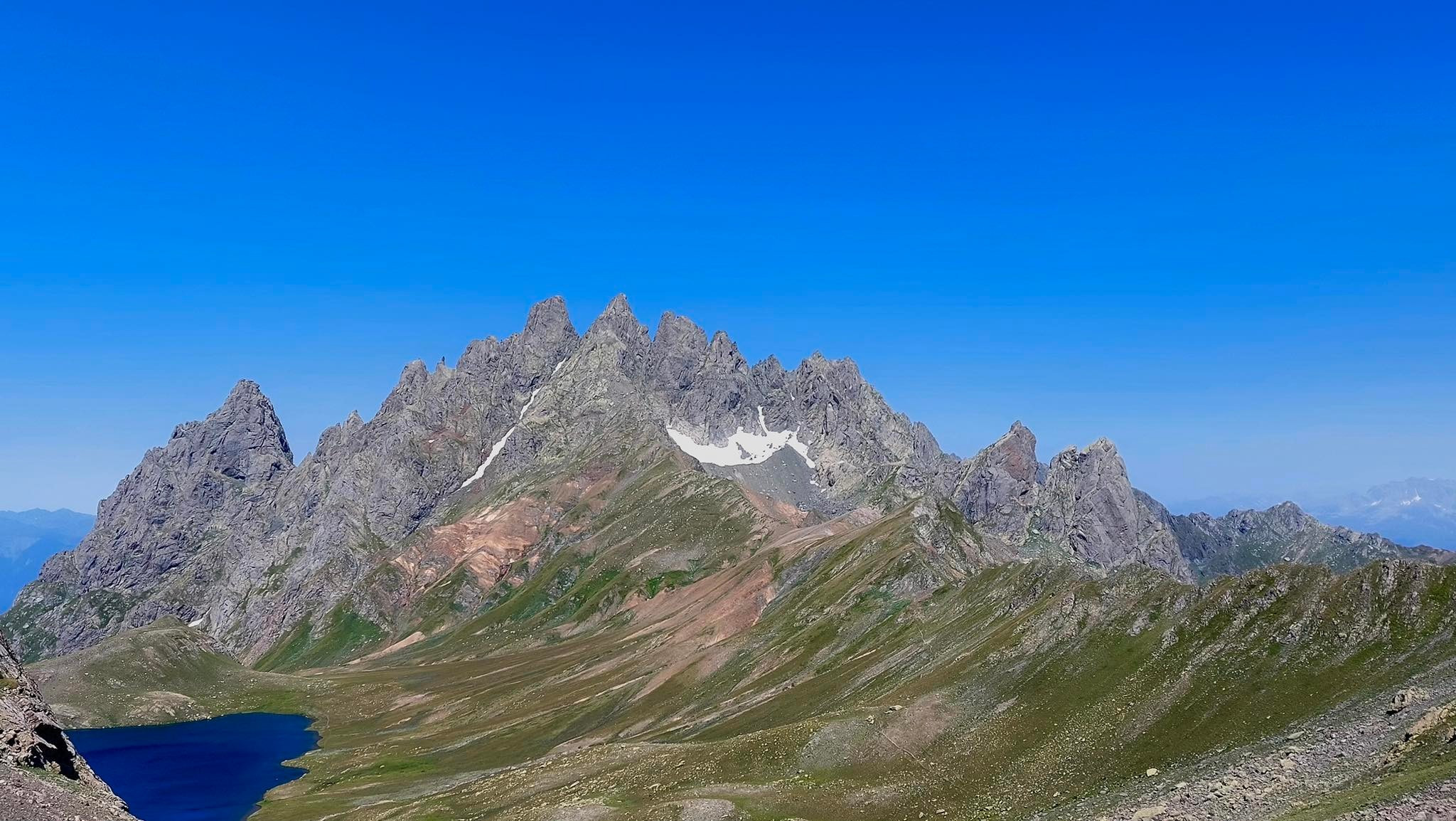
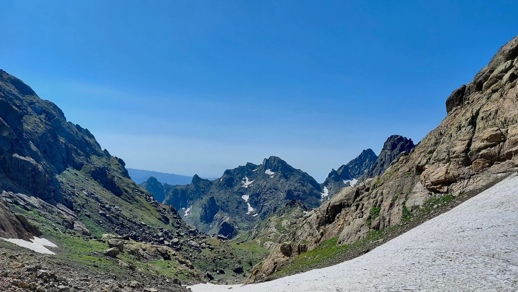
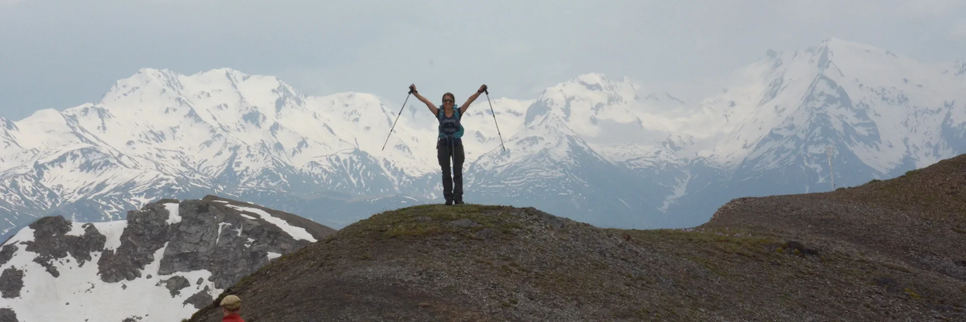
Embark on an unforgettable 11-day journey through Svaneti, one of Georgia’s most unique and picturesque mountainous regions, as you explore the breathtaking scenery of the Caucasus on a thrilling trekking adventure. Located on the southern slopes of the Greater Caucasus range, Svaneti offers a mix of history, culture, and natural beauty. Throughout the tour, you’ll explore charming towns like Lentekhi and Mestia, as well as remote villages such as Adishi, Ushguli, and Mukhuri. The trek also includes visits to stunning locations such as the enchanting Tobavarchkili lakes, high-altitude mountain passes, and spectacular landscapes. On average, we’ll cover about 10 kilometers a day—some days a bit more (up to 16 km), and others a bit less (around 5 km). The terrain and elevation will vary, so good physical fitness is essential to handle several hours of hiking each day. A detailed daily itinerary is available below to help you understand the overall pace, and feel free to reach out if you’re unsure whether your fitness level matches the demands of the trek. While we’ll maintain a steady pace, there will be plenty of opportunities to pause and soak in the unique charm of each destination. If this exciting trekking experience in the Caucasus sounds like your next adventure, get in touch with me today so we can begin planning your incredible Svaneti hike. I’m excited to guide you on this journey!

1
Tbilisi - Lentekhi
2
Lentekhi – Latphari pass – Ushguli

From Lentekhi we’ll be transferred to Latpari pass by 4WD car. Once there, we will continue walking on the ridge, in direction of Ushguli with amazing views of upper Svaneti and its snow-capped mountains and rock massifs of Bezengi wall, on which lies the highest peak of Georgia – Shkhara (5200m).
We’ll have lunch on a ridge at an alpine lake.

• Lowest elevation: 740m
• Highest elevation: 3010m
• Total walking distance: 16km (mostly descent)
• Difficulty: Medium

3
Ushguli – Khalde – Chkutnieri pass – Adishi

From Ushguli we’ll be transferred to village Khalde by 4x4 car. Then from the Khalde valley, we’ll cross the river and after about 5km after following adishistskali river valley we’ll descend to Adishi. Overnight at the guesthouse.
Lowest elevation: 2085m
Highest elevation: 2980m
Distance: 14km
Difficulty: Hard

4
Adishi – Mestia

In the morning we’ll be transferred to Adishi, where we start hiking toward the ski resort of Tetnuldi. From the ski resort, we’ll descend to Jabeshi.
Lowest elevation: 1460m
Highest elevation: 2520m
Distance: 12km
Difficulty: Moderate

5
Mestia - Mukhuri

Transfer to Mukhuri.

6
Mukhuri – Natipuri campsite – Okhoje lake (small Toba lake)

From Mukhuri we’ll take the old Russian 6x6 truck and get to Natipuri campsite, where we start the hike. During the day we’ll hike through the vast forest and alpine meadows to get to Okhoje pass (2750m), cross the pass, and descend to the lake. Overnight in tents at the campsite near the lake
Distance: 10km
Difficulty: Hard

7
Okhoje Lake – Big Toba Lake

After lunch and getting packed we’ll hike up the second pass of 2920m to get to the Greater Toba lake. The path is quite demanding as it goes via the big stones and snowfields but is relatively short. The hike will take about 4 hours.
Distance: 4km
Difficulty: Hard

8
Greater Toba Campsite – Didi Ghele – Lake Kaliashi – Toba campsite

We’ll leave our camp and hike to explore the surrounding of the greater Toba lake as there are lots of nature wonders and amazing landscapes: lakes Kaliashi and Didi Ghele.
Overnight at the Greater Toba campsite.
Distance: 10km
Difficulty: Moderate

9
Greater Toba Campsite – Jolora River Campsite

The hardest day From the lake, we descend into the Magana valley. The pathway is very narrow and requires careful hiking. On our way, we will also visit the stunning Toba waterfall. After we pass a local shepherd, we follow downstream of river Magana. The trail is hard because of the narrow path through huge stones, forests, and bushes.
Campsite near Jolora river at the shepherd's hut
Distance: 14km
Difficulty: Hard

 
10
Jolora river campsite – Kirnakhona – Skuri – Martvili

We will hike into the sub-tropical forests of moss-covered trees and stones. The majority of the vegetation includes wild hazelnuts and blackberry bushes, so if you get here during the proper season you can enjoy them too.
From Kirnakhona we’ll be picked up by 4x4 car and transferred first to the Skuri and then to Martvili to the Guesthouse.

11
Martvili – Tbilisi

On the way back to Tbilisi we’ll have the opportunity to discover Martvili Canyon, Prometheus cave, or visit Kutaisi (optional).

Package Trip Status Price PP In a Group
Confirmed Dates Min.participant Number 3p / Max.participan Number 10p 3-6 People Group 7-10 People Group 11-12 People Group
 19.07.2025 -29.07.2025 Bookable  €2,545 €1,965 €1,795 

 30.07.2025 -09.08.2025

Bookable €2,545 €1,965 €1,795 

 20.08.2025 -30.08.2025

Bookable €2,545 €1,965 €1,795 


Tour price includes:

  • Accommodation included
  • Guiding fee
  • Breakfast
  • Lunch
  • Dinner
  • Transport during the trip
  • Mountain guide expenses
  • Luggage transfer
  • Mules and horses
  • Tents
  • Cooking utensils 

 Tour price excludes:

  • Alcohol drinks
  • Overnights in Tbilisi
  • Sleeping bags
  • Tips 
Back